Tomorrow.io render of satellite

Tomorrow.io's radar satellites use machine learning to punch well above their weight

Tomorrow.io render of satellite

Image Credits: Tomorrow.io

Those of us lucky enough to be sitting by a window can predict the weather just by looking outside, but for the less privileged, weather forecasting and analysis is getting better and better. Tomorrow.io just released the results from its first two radar satellites, which, thanks to machine learning, turn out to be competitive with larger, more old-school forecasting tech on Earth and in orbit.

The company has been planning this mission since it was called ClimaCell, back in 2021, and the results being released today (and formally presented at a meteorology conference soon) show that their high-tech approach works.

Weather prediction is complex for a lot of reasons, but the interplay between high-powered but legacy hardware (like radar networks and older satellites) and modern software is a big one. That infrastructure is powerful and valuable, but to improve their output requires a lot of work on the computation side — and at some point you start getting diminishing returns.

This isn’t just “is it going to rain this afternoon” but more complex and important predictions like which direction a tropical storm will move, or exactly how much rain fell on a given region over a storm or drought. Such insights are increasingly important as the climate changes.

Courtesy of AI: Weather forecasts for the hour, the week and the century

Space is, of course, the obvious place to invest, but weather infrastructure is prohibitively big and heavy. NASA’s Global Precipitation Measurement satellite, the gold standard for this field launched in 2014, uses both Ka (26-40 GHz) and Ku (12-18 GHz) band radar, and weighs some 3,850 kilograms.

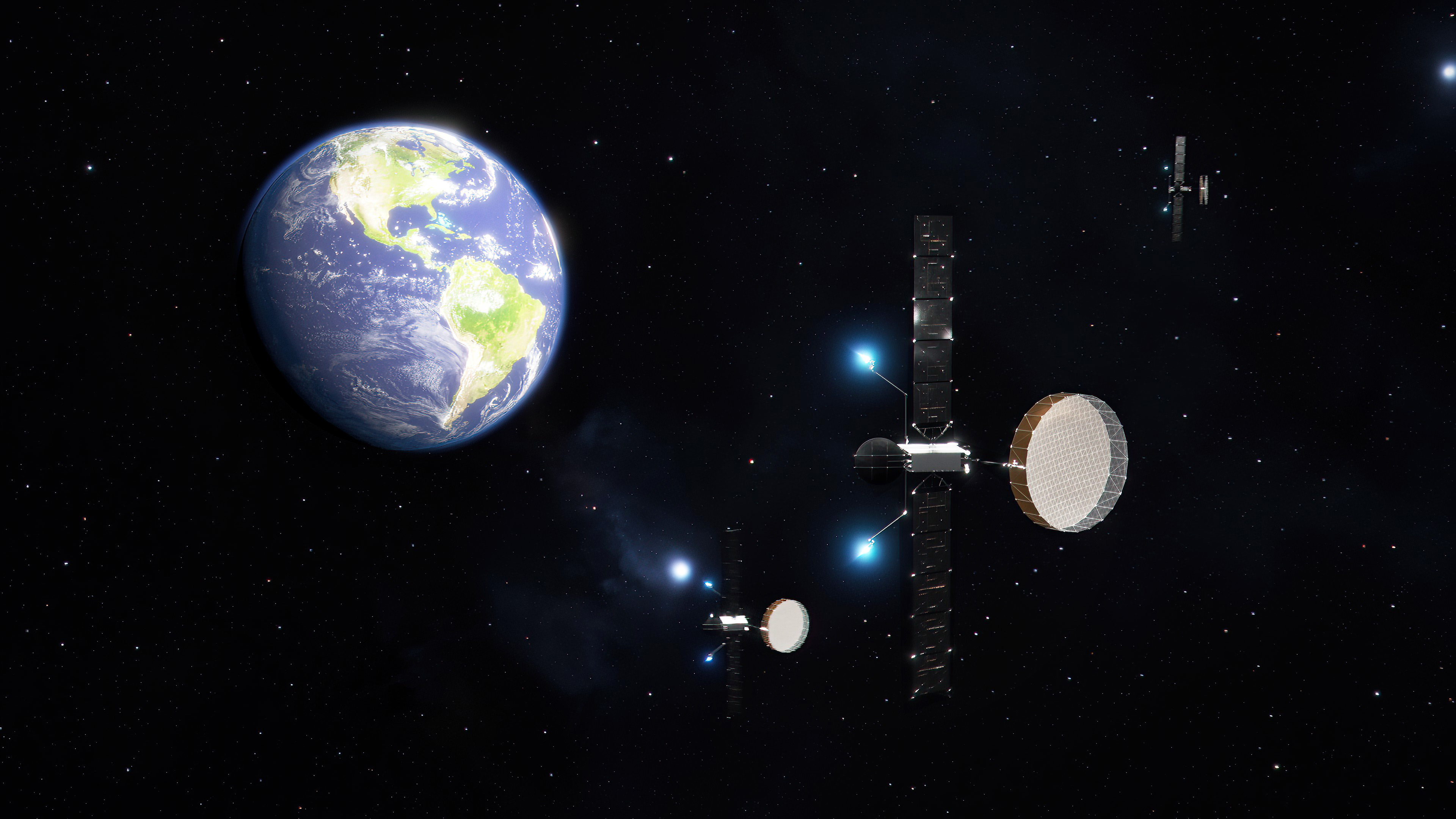
Tomorrow.io’s plan is to create a new space-based radar infrastructure with a modern twist. Its satellites are small (only 85 kilograms) and use the Ka-band exclusively. The two satellites, Tomorrow R1 and R2, launched in April and June of last year, are just now, after a long period of shake-out and testing, beginning to show their quality.

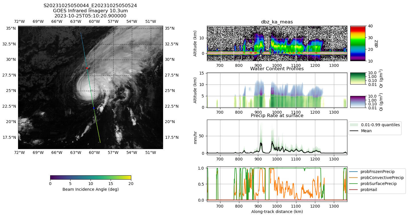
In a series of experiments that the company is planning to publish in a journal later this year, Tomorrow claims that with only one radar band and a fraction of the mass, their satellites can produce results on par with NASA’s GPM and ground-based systems. Across a variety of tasks, the R1 and R2 satellites were able to make similarly accurate or even better and more precise predictions and observations as GPM, and their results also tallied closely with the ground radar data.

Examples of data from the R1 and R2 satellites. Image Credits: Tomorrow.io

They accomplish this though the use of a machine learning model that, as Chief Weather Officer Arun Chawla described it, acts as two instruments in one. It was trained on data from both of the GPM’s radars, but by learning the relationship between the observation and the difference between the two radar signals, it can make a similar prediction using just one band. As their blog post puts it:

The algorithm is trained with these dual-frequency-derived precipitation profiles but only uses the Ka-band observations as input. Nevertheless, the complex relationship between the reflectivity profile shape and precipitation is “learned” by the algorithm, and the full precipitation profile is retrieved even in cases where the Ka-band reflectivity is completely attenuated by heavy precipitation.

It’s a big success for Tomorrow.io if these results pan out and generalize to other weather patterns. But the idea isn’t to replace the U.S. infrastructure — GPM and the ground radar network are here for the long haul and are invaluable assets. The real problem is that they can’t be duplicated easily to cover the rest of the world.

The company’s hope is to have a network of satellites that can provide this level of detailed prediction and analysis globally. Their eight planned production satellites will be bigger — around 300 kg — and more capable.

“We are working on providing real-time precipitation data anywhere in the world, which we believe is a game changer in the field of weather forecasting,” Chawla said. “In that respect we are working on accuracy, global availability and latency (measured as the time between the signal being captured by the satellite and the data being available for ingesting into products).”

They’re also making the inevitable data play, with a more detailed set of orbital radar imagery to train their own and other systems on. For that to work, they’ll need lots more data, though — and they plan to pick up the pace collecting it with more satellite launches this year.

Astranis Omega 'MicroGEO' satellites beaming dedicated broadband to Earth

Astranis unveils Omega 'MicroGEO' satellites for beaming dedicated broadband down from high orbit

Astranis Omega 'MicroGEO' satellites beaming dedicated broadband to Earth

Image Credits: Astranis

Astranis has taken the wraps off a new generation of communications satellites that will serve broadband to customers on Earth from geostationary orbit, but faster and smaller than any comsat up there. They believe the future of orbital communications is not just in higher orbits, but in the possibility of customers — government and commercial — having their very own private satellite network.

Called Omega, the new class of satellites will each provide some 50 gigabits per second of bandwidth in both civilian and military Ka bands — making it clear from the outset that this is intended to be a dual-use technology.

Astranis builds and operates relatively small broadband satellites in high orbits, and sells that capacity on to telecom and internet service providers. The company has contracts to provide capacity to providers in Mexico, the Philippines, Alaska and southeast Asia.

The startup takes pride in the comparatively diminutive size of its GEO satellites, which are normally huge and, as a result, easy to track and potentially attack.

“We need to move to a more resilient architecture. No more big, fat, juicy targets!” said Astranis CEO John Gedmark at an event at Space Symposium where the news was announced.

The improved bandwidth is thanks to a next-gen Astranis software-defined radio, but the signal is deployed more efficiently; while the previous generation sent down a set of coherent beams, like spotlights, the new generation is more like a big LED array, providing even signal across a much greater area. Gedmark said that although the number of points that can be served depends on the customer and use case, it is theoretically in the millions. The satellites use existing Ka-band receivers rather than a bespoke antenna like Starlink’s.

Speaking of competitors: When asked about how the orbital communications market would develop in the near term, Gedmark was highly optimistic. He said that the appetite for bandwidth is effectively unlimited, at least at the prices they are able to offer, which are well below legacy GEO data connections.

Image Credits: Astranis (opens in a new window)

Notably, Astranis said the satellite will support specific waveforms that are of interest to the DOD, like the Protected Tactical Waveform, so it can still provide capacity even in contested environments. Astranis’ proposal — many small satellites in GEO — is a far cry from legacy tech, which has generally relied on very large, and very expensive, non-maneuverable satellites in GEO. In other words, sitting ducks for adversaries.

Like the company’s current satellites, Omega will have the ability to maneuver in GEO using on-board all-electric propulsion. Astranis said the more efficient thrust will allow it to keep its station for at least 10 years, as well as perform plenty of repositioning and other maneuvers. By that time the next generation will probably be ready to slot into place.

What will perhaps be Astranis’ standout product, however, will be dedicated satellites for customers. Obviously nations have their own dedicated spy satellites and the like, but these cost hundreds of millions of dollars and are often funded by defense budgets. But even multinational corporations don’t tend to have that kind of cash laying around, for that purpose at least — and if they did, they don’t tend to have satellite management departments. Astranis plans to essentially offer “satellite as a service” instead, where for an upfront and monthly fee a satellite can be tasked completely (or in part) to the use of a single customer.

Gedmark declined to name any of the companies that had expressed interest or were being wooed in other ways, but he did suggest that energy and oil and gas companies are an obvious one, with holdings across large geographical areas and demand for a good deal of secure satellite data. He also said that, while there are no official plans as yet to approach the cislunar market, there is a huge opportunity there for future growth.

The company aims to complete the first Omega satellite in 2025 and launch to orbit in 2026. The plan is to launch on the order of six satellites at that time, with as many as 24 per year being launched after that depending on how manufacturing scales up.